UNESCO Global Geoparks
The long coastal strip here in South-West Norway has facilitated trade and travel through several historical eras. This has also shaped our culture and cultural heritage in the Magma UNESCO Global Geopark.
The long coastal strip here in South-West Norway has facilitated trade and travel through several historical eras. This has also shaped our culture and cultural heritage in the Magma UNESCO Global Geopark.
Magma UNESCO Global Geopark consists of the municipalities of Eigersund, Sokndal, Flekkefjord, Lund and Bjerkreim, and includes the counties of Rogaland and Vest-Agder in south-west Norway. The area has been awarded the status of UNESCO Global Geopark thanks to the international geological significance of the area, and for the work carried out since 2006 in the field of sustainable development. At the same time, it also turns out that Magma Geopark has a lot to show in the cultural and historical aspect.
After the Ice Age, the people in the area began to organize themselves into villages. These became increasingly complex towards the so-called pre-Viking period. Archaeological artefacts from pre-Viking, Viking and migration periods have been discovered at several sites in the Magma UNESCO Global Geopark.
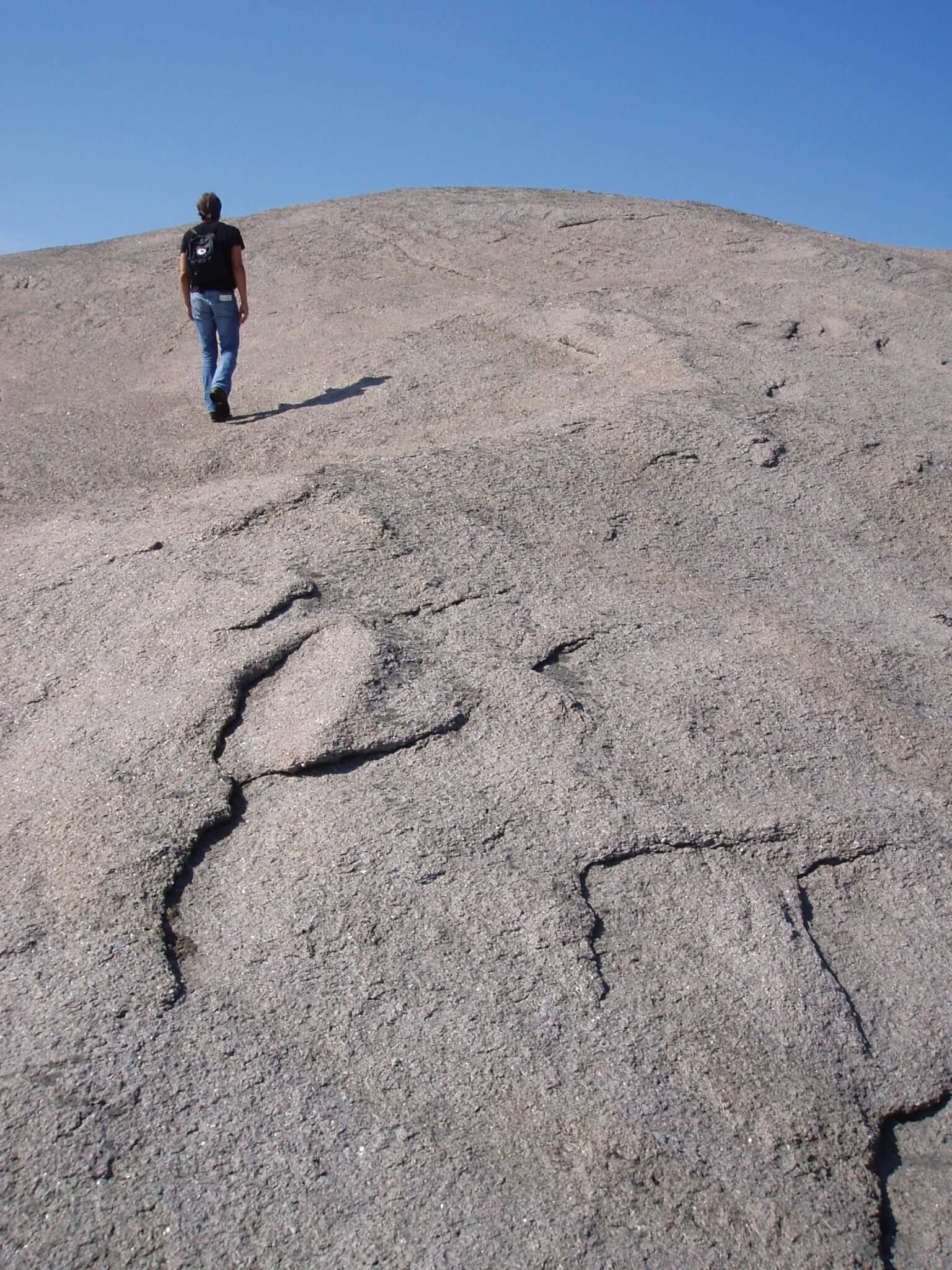
In this part of Norway, the synergy between the unique landscape, which mainly consists of anorthosite, igneous rocks and human development, is evident in the ancient settlements that have been uncovered. The special chemical composition of anorthosite, which means that it is very poor in minerals, means that there is very little vegetation that thrives here. The area also bears traces of the many ice ages that have covered the area, and the natural erosion caused by weather and wind.
The combination of the different influences creates rock that has different iconic shapes, but also moraines, stone clocks and shifting blocks. In some areas, other rock types have pressed into the anorthosite. So-called layered intrusions have then arisen. These intrusions consist of layers that are alternately rich in light and dark minerals. One of these minerals is magnetic and is called Magnetite. These rocks weather easily, but precisely for this reason they provide good conditions for vegetation with their rich soil that is rich in natural fertilizers, including phosphorus.
As a result of these factors we can state that the Magma UNESCO Global Geopark is largely a relatively flat, rocky area consisting of both fertile and less fertile land. In addition, there is great permeability in the anorthositic landscape. This means that the rainwater is able to filter deep into the ground and reappear in the form of approx. 6,000 lakes and many rivers, which facilitate a good spread of human settlements.
The long coastal strip here in South-West Norway has facilitated trade and travel through several historical eras. This has also shaped our culture and cultural heritage in the Magma UNESCO Global Geopark.
The archaeological finds can be divided into three main periods:
In Magma Geopark we find several cultural and historical locations, but only a few are dated this far back in time:
The first can be found at Rossland near Haugen in Sokndal municipality. This area has been categorized as a sacrificial site, and is dated back to the early Iron Age (500 BC – 550 AD). The objects consist of an altar and a stone head. In addition, other finds have been recorded nearby, such as dwellings, graves, sacrificial vessels and upright stones known as phallus stones. The altar is often associated with fertility rituals, and sacrifices to gods in the context of such ceremonies.
The other area of great archaeological interest is Solbjørgnipa. At Solbjørgnipa we find remains of buildings, graves and animal traps. These finds are considered to be one of the most important finds in Rogaland from the Iron Age, and are dated to NOK 220-500 AD. By studying these finds, you find information about daily life and families, as well as how the culture of the time related to both life and death. Despite the impressive size of the area, the farm buildings at Bue are a typical example of an Iron Age farm. In addition to several large round mounds, a rectangular mound represents an unusual burial site. The somewhat disturbed short end of the rectangular tomb reveals how it was built using an even row of stones placed on both sides. The long hill is constructed as a ridge extending from the plateau with access from the north and must have required a lot of work. Remains of a house are visible as low, disturbed rows of stone directly behind the rectangular long elevation. Both people and animals lived in these buildings, and the remains of stone walls down on the field indicate that animals were led through adjacent fields to a grazing area further south.
On the hill we also find two animal traps. They are ideally placed in relation to the terrain, and you can find them just above the top of a mountainside at the top of a wide grassy slope. The larger trap is well preserved with stones visible along the edge, while the smaller one has collapsed. Archaeological excavations in Setesdal show that five out of six dated animal traps were built in the Iron Age and the early Middle Ages. Game animals are considered to have been a supplementary food source for agricultural societies.
The third location of particular archaeological interest is Stoplesteinan and St. Olavsvei. The cobblestones consist of 16 stone blocks placed in a circular pattern. The circle has a diameter of 21 meters and consists of stones measuring up to 1.2 meters. The stone circle is located at the top of Skårabrekkå on part of the old farm Årstad. Årstad was the largest, and one of the oldest farms in the district. It is believed that the old Egersund had its origins precisely on the land of Årstad farm, and this farm is believed to have existed since the Viking Age.
It is unknown why this circle was built. According to the legends, the Stoplesteinane can be dated to the Viking Age (800 - 1000 AD). One assumes that this was a place where things were kept. Courts were often located in well-known and easily visible places, such as on a hilltop such as Stoplesteinan. Things were also often placed near burial sites. Similar stone circles also exist elsewhere in Norway and in Northern Europe, but are rare. Some have been excavated and classified as graves from the end of the Bronze Age (1800 – 500 BC) until the end of the Iron Age (500 BC to AD 600). It is still uncertain whether this is the case for Stoplesteinan, but in 1930 layers of ash were found in the middle of the circle. This gives indications that this may be an old burial site rather than an object. Another theory is that Stoplesteinan is a burial site from the older Iron Age that may have been used as a courthouse in the Viking Age
Bell stones or singing stones are part of the natural and cultural heritage that has received little attention. The geological and acoustic phenomenon that certain boulders make a metallic or bell-like sound when struck with smaller stones is known in several places around the world. From the Norwegian area, we know of an ever-increasing number. They have different names, such as bell stones, singing stones, singing stones or ringing stones.
Beliefs are attached to some of the stones which the local population has taken care of. In addition, many stones are called bell stones because they are linked to legends about church bells, without there being any sound in the stone itself. We record everyone, in the meeting between stone and meaningful sound - between geology and cultural history.
Today bunads are more popular than ever, and there are around 450 suits and garments that go by the name bunad. The use of bunads in Norway is quite unique compared to other countries that also have their own folk costumes that are only used for folk dances. Norwegians love to bring out their bunads as soon as the occasion arises, whether it is May 17, weddings, baptisms, confirmations or Christmas celebrations . Bunad is also approved as gala attire, and can therefore be worn if you are invited to a castle dinner.
It was at the end of the 18th century that the first interest in the traditional folk costumes in Norway began. But it was only in the middle of the 19th century, when national romanticism spread across the country, that peasant culture and their costumes were seen as valuable. These folk costumes became a dear source of motivation for artists, and eventually the national feeling was also expressed in most people who started to use the costumes.
In the first period of the 20th century, many of the bunads that we know today were composed. The typical thing for these bunads was that you had to wear a white, embroidered shirt and a woolen bunad with a different color on the waist and lining, and with home-sewn embroidery. Around the turn of the century, the Hardanger bunade had also taken hold, and was called the "national" or the national dress. Bunad spread like a plague across the country and even in Setesdal you got hardanger bunad.
Information from: https://www.bunadrosen.no/bunadens-historie
The sheep is one of our oldest livestock in Norway. We have long traditions for caring for and using wool. There are over 14,000 farms with sheep in Norway, spread across the country. On these, there are just under a million winter-fed sheep that get just over a million and a half lambs. In total, over 4,000 tonnes of Norwegian wool is produced annually.
It is assumed that the sheep came to Norway over 6,000 years ago. The sheep was one of our earliest domestic animals. Since then, grazing, mowing and other outdoor use have helped shape a varied and content-rich landscape.
Norway has relatively little agricultural land. Only 3% of the Norwegian land area is cultivated land. Of the cultivated area, two thirds are best suited for grass production. Large fodder resources are also available in the outback. In the summer, 2.4 million animals, of which 2.1 million are sheep, are released to graze in open fields. Most of what the sheep eats is grass and other forage. In this way, the sheep is able to utilize resources that cannot be used for human food directly, and transform these resources into high-quality products such as meat and wool.
Magma geopark supports local wool producers.
Information from: https://www.norilia.no
GEOfoodEDU is a two-year project, financed by NORA (Nordic Atlantic Cooperation). GEOfoodEDU, led by Magma Geopark, will work to develop innovative strategies for sustainable development, and work to facilitate good practices related to food consumption through the development of tailored learning materials. GEOfoodEDU aims to expand use of the brand to the NORA region , with local food producers, restaurants, incentives for the use of km-zero food chains and the use of traditional regional food. The GEOfoodEDU partners will investigate the possibility of creating GEOfood routes tailored for "slow travel" and based on local cultural heritage.