Tellnes mines - One of the world's largest
In Tellnes is the world's largest ilmenite-norite intrusion.

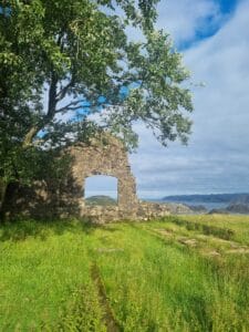
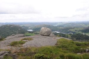
Brufjell i Åna-Sira ruver 184 meter over havet og byr på en imponerende utsikt over Listalandet. Fra fjelltoppen leder en merket sti ned til jettegrytene, som ligger på et platå rundt 20 meter over havnivå, arrangert på rekke og rad.
Fra toppen av Brufjell i Flekkefjord kan du nyte en spektakulær panoramautsikt over kysten, helt til Lista fyr. Brufjell, byr på en fantastisk utsikt, og de imponerende jettegrytene er verdt besøket alene. Beregn minst fem timer til turen.
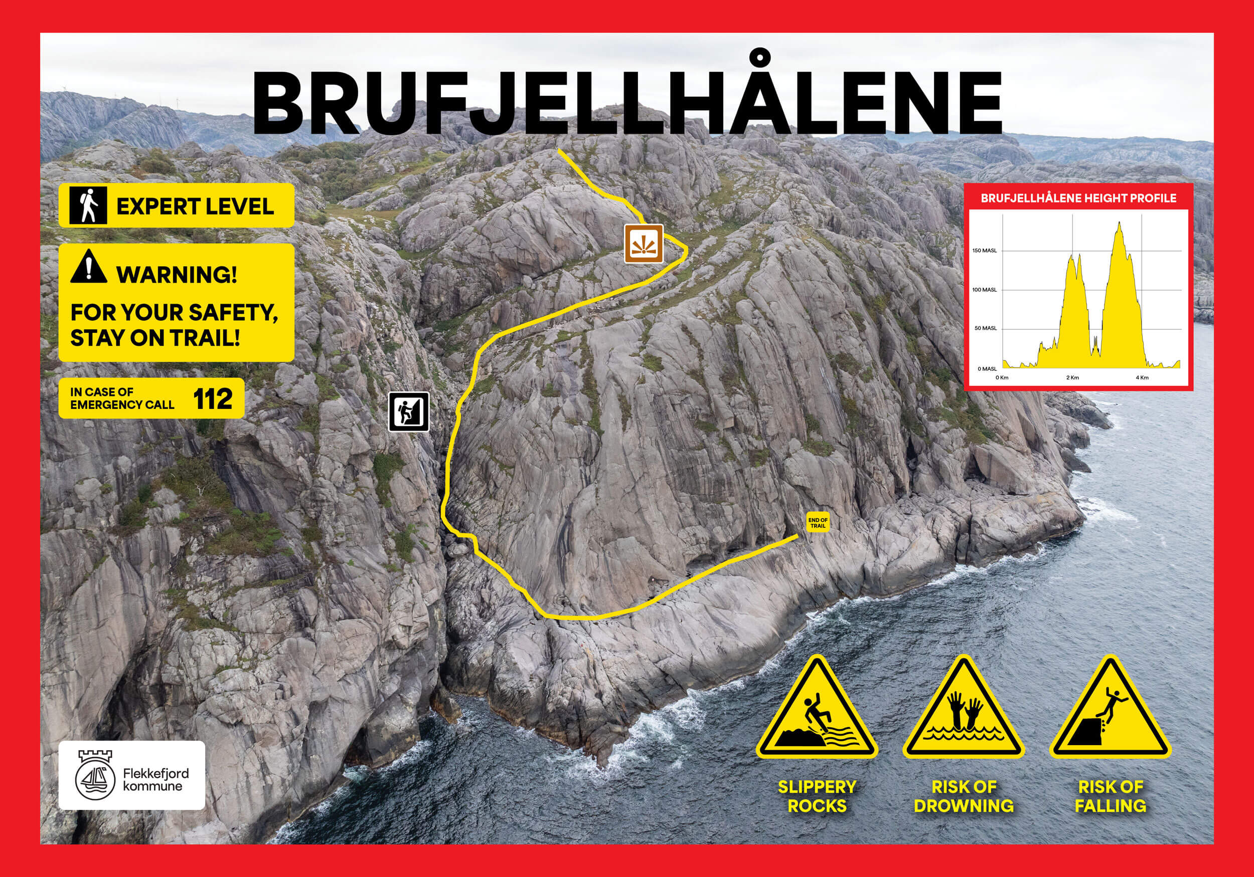
Nedstigningen til jettegrytene er svært bratt, og de som sliter med høydeskrekk kan oppleve det som utfordrende. Steinura kan være løs, og det er nødvendig med litt klatring på skrå berg med bruk av de monterte håndtakene. Disse håndtakene gjør det enklere for voksne, men turen kan være krevende for små barn og anbefales ikke for de under 10 år. Å gå ned til jettegrytene i regnvær frarådes, da underlaget kan bli svært glatt.
Turen som helhet kan være krevende og inkluderer partier med bratt klatring. Metallhåndtak er satt opp for å lette passasjen, og det krystallklare fjellvannet som renner nedover kan drikkes. Husk å bruke gode sko for turen. På toppen av Brufjell finner du også en postkasse der du kan skrive navnet ditt som en minnerik avslutning.
Caution! Warning!
Down by the Brufjell Caves, you stand on a ledge with a cliff that drops directly into the open sea, where strong currents and large waves are often present. Falling into the water here is life-threatening!
Follow road FV44 towards Åna-Sira and continue following signs towards "Roligheten". After approximately 1.5 km, you will see the parking lot on the left side. Continue on foot while enjoying the surroundings. The trail starts where the road ends. Contact Magma Geopark if you want a great experience with a professional guide.
Accessibility: Difficult hike. The descent to the caves is very steep and involves climbing. It is categorized as black level difficulty. Therefore, we advise against bringing small children on this part of the hike. Some handholds have been drilled into the rock to make the climbing more manageable. Bringing dogs on this hike is not recommended. Marked trails are available.
Det anbefales ikke å bruke stien til Brufjellhålene i vinterhalvåret. All ferdsel til Brufjellhålene skjer på eget ansvar. Flekkefjord kommune stenger Brufjellparken for sesongen fra 1. november til og med 1. mars, og dette inkluderer også toalettfasilitetene ved Brufjell.
Show consideration:
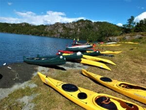
The area around Roligheten offers a large selection of natural attractions on a three-hour trip through the coastal landscape. The path passes a panoramic view of the coast at the top of Brufjell, continues to the exotic Sandviga beach with white pebbles, and finally leads you to a spectacular rock formation from the Ice Age; large potholes are located in the steep rock wall rising from the sea.
Earthquakes were common in this area in the past and the evidence of this is visible even today. In the Sireåna valley near Lundevatnet, some geological units south of the valley have been shifted around 500 meters to the east due to a geological shift. Today, the Sireåna River follows the line of this displacement. The movement has occurred in steps, a few centimeters or meters at a time, which led to the earthquakes around Brufjell.


Category:
Active, Flekkefjord, Geopark, Magma Geopark Sites, Top 20, Suggestions
See more experiences in Magma Geopark