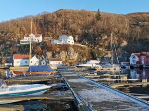
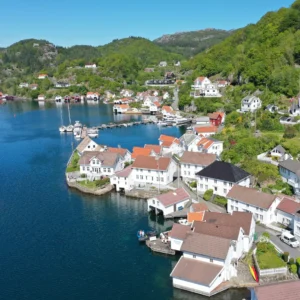
Veisevågen marina
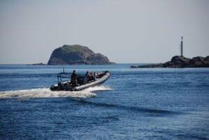
If you come by sea to Rasvåg on Hidra, you will find a…

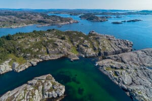
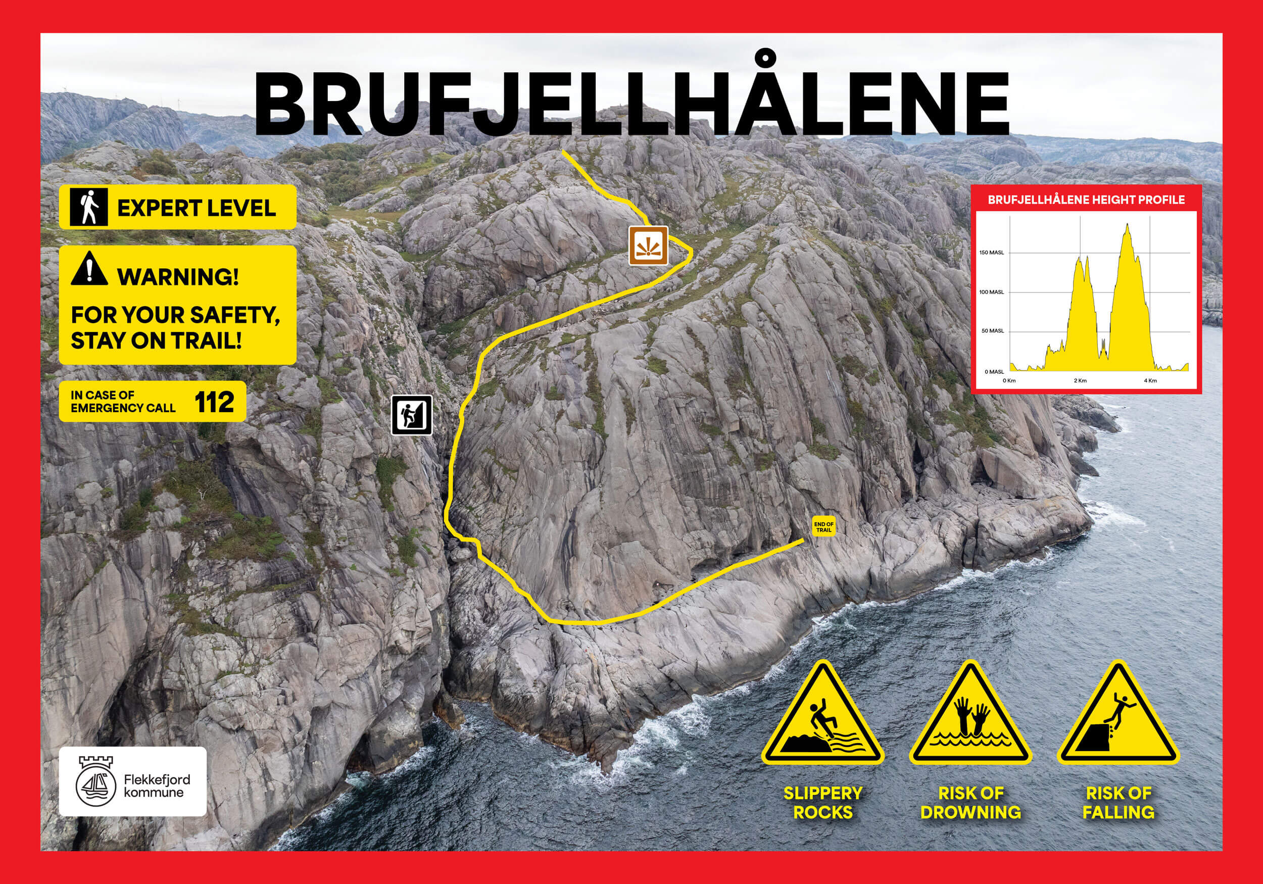
Brufjell in Åna-Sira towers 184 metres above sea level and offers an impressive view of Listalandet. From the mountain top, a marked trail leads down to the potholes, located on a plateau around 20 metres above sea level.
From the top of Brufjell in Flekkefjord, you can enjoy a spectacular panoramic view of the coast, all the way to Lista lighthouse. Brufjell offers fantastic views, and the impressive potholes are worth the visit alone. Allow at least five hours for the trip.
The descent to the potholes is very steep and those with a fear of heights may find it challenging. The stone wall can be loose, and some climbing on sloping rock is necessary using the mounted handles. These handles make it easier for adults, but the hike can be demanding for small children and is not recommended for those under the age of 10. Descending to the potholes in rainy weather is not recommended, as the surface can become very slippery.
The hike as a whole can be demanding and includes sections of steep climbing. Metal handrails are set up to ease the passage, and the crystal-clear mountain water flowing down can be drunk. Remember to wear good shoes for the hike. At the top of Brufjell you'll also find a post box where you can write your name as a memorable ending.
Caution! Warning!
Down by the Brufjell Caves, you stand on a ledge with a cliff that drops directly into the open sea, where strong currents and large waves are often present. Falling into the water here is life-threatening!
Follow road FV44 towards Åna-Sira and continue following signs towards "Roligheten". After approximately 1.5 km, you will see the parking lot on the left side. Continue on foot while enjoying the surroundings. The trail starts where the road ends. Contact Magma Geopark if you want a great experience with a professional guide.
Accessibility: Difficult hike. The descent to the caves is very steep and involves climbing. It is categorized as black level difficulty. Therefore, we advise against bringing small children on this part of the hike. Some handholds have been drilled into the rock to make the climbing more manageable. Bringing dogs on this hike is not recommended. Marked trails are available.
It is not recommended to use the trail to Brufjellhålene during the winter months. All traffic to Brufjellhålene is at your own risk. Flekkefjord municipality closes Brufjellparken for the season from 1 November to 1 March, and this also includes the toilet facilities at Brufjell.
Show consideration:
Brufjellhålene are good examples of potholes. Potholes are often seen as deep, round pits in the rock, and are formed by stones that are set in heavy rotation by flowing water, especially in connection with meltwater under glaciers. The stones grind down in circular movements in the rock over a long period of time.
Brufjellhålene, on the other hand, was formed by continuous wave action during a period known as the Tapes (8000-4000 years ago). After the last ice age, the enormous ice cap that pressed the land down melted away. When the pressure disappeared, the land began to rise - initially several centimetres a year. At the same time, sea levels rose as ice in the polar regions melted as a result of a warmer climate. Both the sea and the land rose at the same speed at Brufjell. This meant that the waves hit the rock face in the same place for several thousand years. These steady, powerful waves ground both the platform and the potholes into the steep rock face as we see them today.
Since then, the global sea level has stabilised, while the land has continued to rise. This is why Brufjellhålene is now 20 metres above sea level.
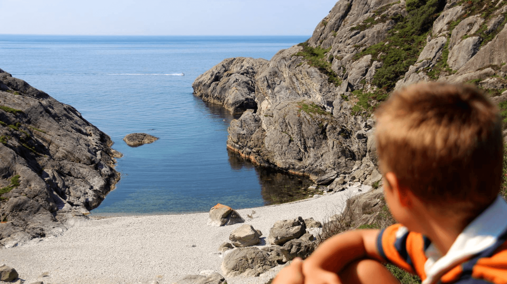
The area around Roligheten offers a large selection of natural attractions on a three-hour trip through the coastal landscape. The path passes a panoramic view of the coast at the top of Brufjell, continues to the exotic Sandviga beach with white pebbles, and finally leads you to a spectacular rock formation from the Ice Age; large potholes are located in the steep rock wall rising from the sea.
Earthquakes were common in this area in the past and the evidence of this is visible even today. In the Sireåna valley near Lundevatnet, some geological units south of the valley have been shifted around 500 meters to the east due to a geological shift. Today, the Sireåna River follows the line of this displacement. The movement has occurred in steps, a few centimeters or meters at a time, which led to the earthquakes around Brufjell.


Category:
Active, Flekkefjord, Geopark, Magma Geopark Sites, Top 20, Suggestions
See more experiences in Magma Geopark