Eigerøy Lighthouse
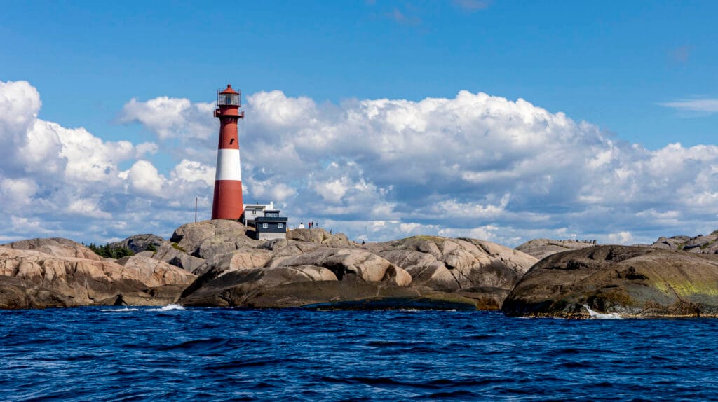
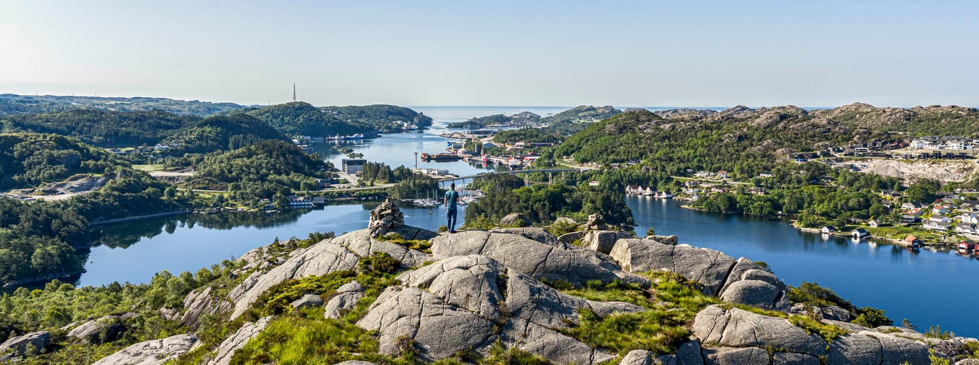
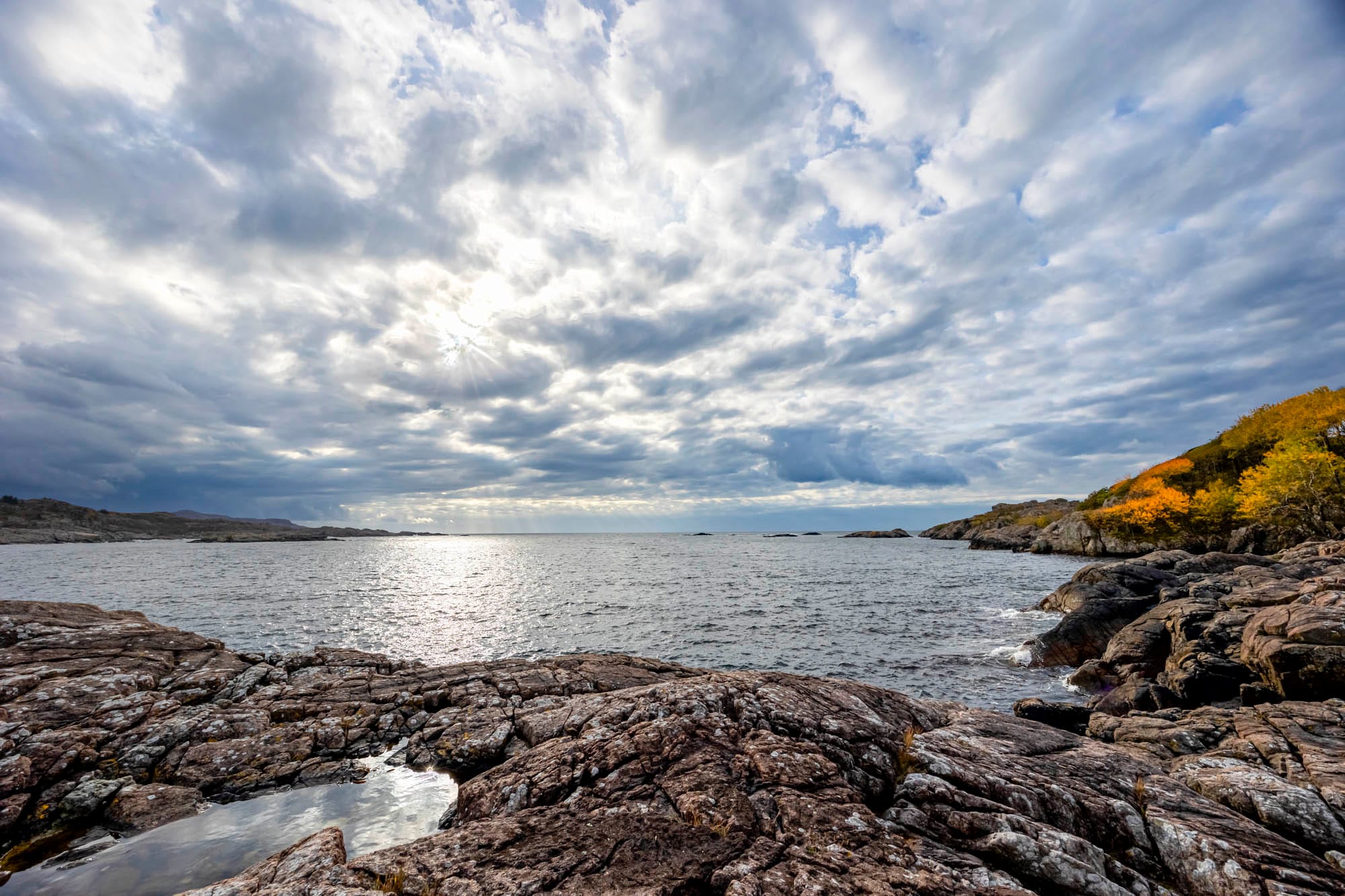
This 4.6-kilometre hike/return starts from the car park at the Eigerøy lighthouse and runs through a bare and beautiful coastal landscape. The area has a very special geology and therefore the status of a geopark area. Magma Geopark's app can satisfy the hunger of the most thirsty for knowledge. For romantics, this is the evening hike that is rewarded with a beautiful and golden sunset in the west. If you get tired, the lighthouse keeper's dwelling can be rented for an overnight stay, with sunrise included.
Access: From the train station, follow rv 42 towards Eigerøy and follow signs to Eigerøy fyr. Due to the very narrow road, only cars and minibuses can drive all the way down to the car park.
Read more about Eigerøy lighthouse here
Trollpikken
Trollpikken became world-famous in 2017 when someone decided to cut it down from the mountain where it had been hiding for almost 10,000 years. The landscape where Trollpikken is located is largely a cultural landscape formed by traditional cultivation and animal breeding. You can see old land boundaries, fences and lakes along the trail, and if you choose to walk from Trollpikken down to Egersund, you'll get a unique insight into how animals and farming have shaped the landscape. A family-friendly hike.
AccessThere are two ways to get to Trollpikken:
1: Follow the motorway FV 42 from Egersund train station in the direction of Krossmoen. After about 2 minutes turn right onto Sletteidveien, signposted Trollpikken. Drive to the car park marked Trollpikken, approx. 3-4 minutes. Follow the marked trail (1.9km one way)
2: It is also possible to follow the marked trail to Trollpikken from Egersund town centre. Walk up to Vannbassengan and then over Veshovda and Mjølhusåsen (Opplev Dalane trail, approx. 6 km).
Read more about Trollpikken here
The old Jæren railway
The old Jær railway line between Hellvik and Maurholen has been adapted as a hiking/cycling route. The road winds between and through rocks and boulders and impressive stonework has been laid down in the old line. A great trip! Parking in Maurholen and at Launes.
Maurholen Station: Maurholen Station is located along the old Jærbanen railway line. Today the venue is rented out for accommodation or private events. Perfect for summer and garden parties with family activities and barbecues. Contact Eigersund Municipality for an appointment. Year-round licence required.
Access from Egersund: follow the 502 towards Eigerøy, turn left before the tunnel. Large car park. Signposted road.
Read more about Den Gamle Jærbanen here
Vannbassengan
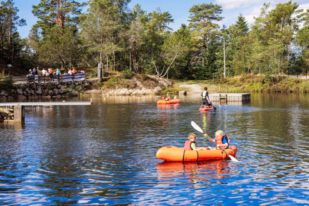
With its location, nature and user-friendly organisation, Vannbassengan is one of the most used outdoor recreation areas in Dalane. The area has rich vegetation and several kilometres of nature and culture trails. Here you'll find illuminated trails, viewpoints and picnic areas with plenty of opportunities to engage in activities such as jogging, fitness, ball sports, beach volleyball, barbecues and swimming. You'll also find a natural fitness track at Låvaberget. The area is well organised for wheelchair users. HC car park. All-year leash requirement. Separate release area.
Access: Egersund town centre, a few hundred metres in the direction of Sokndal. Here you will find the sign that leads you up to a large car park and out into the nature of this special but beautiful area.
Read more about Vannbassengan here
Launesfjellet
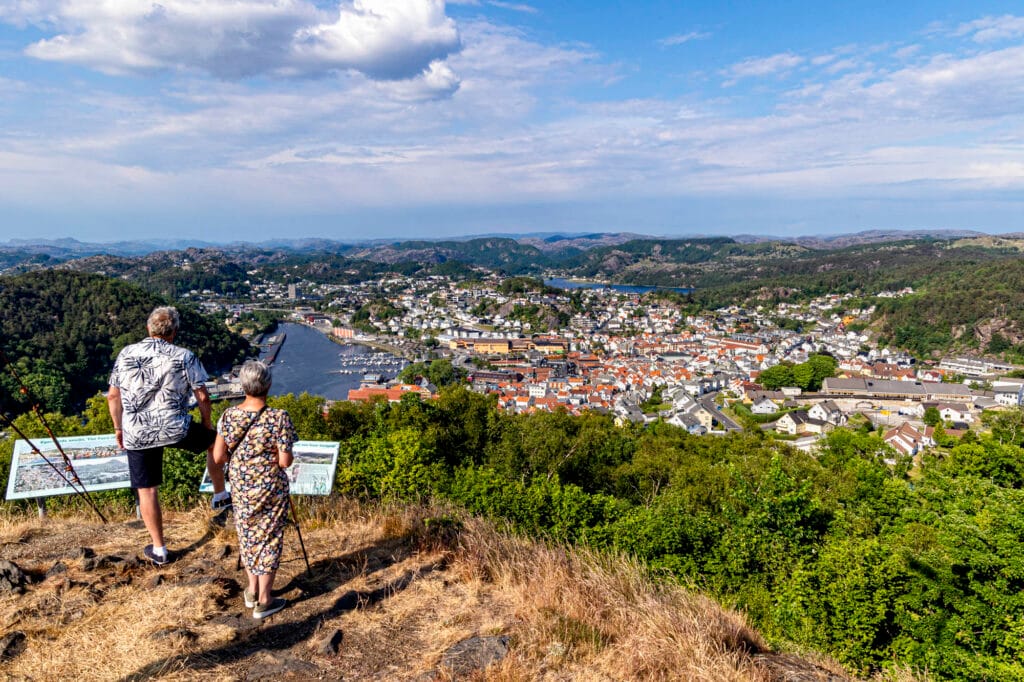
A moderately tough summit tour in varied terrain and with a steady incline. Great views at the top towards the town, Eigerøy, even Sokndal, Bjerkreim and the North Sea. Railway and war history memories along the way.
Tour length: 3.9 km, round trip. Animals on pasture. Read full description here.
Access: From Rv 44, turn off at Eie in Egersund, towards Eigerøy, RV502. After 500 metres, turn left. Follow signs to the car park for Den gamle jærbanen.
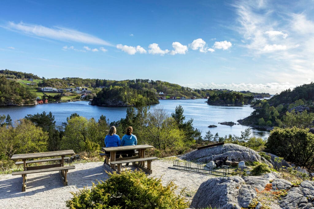
Auglend

Auglend is a rich outdoor recreation area located at the southern tip of Søre Eigerøya. In 1995 it was named Norway's outdoor recreation area of the year. This used to be a typical coastal farm where fishing and farming went hand in hand - a so-called combination farm. The infield has sheltered and idyllic grass meadows surrounded by lush deciduous forest belts. The outfield stands in stark contrast with grey rocks and crags, which are interwoven with barren heather and grassland. Bare, weather-worn rocky shores form the edge of the sea. The marine environment in Vandringshavn is the heart of the area. Auglend is a great walking area suitable for the whole family. Good car parking, nature and cultural information, toilets, marked trails etc. Year-round track compulsory.
Access: Follow Rv. 502, turn left after Eigerøy bridge. Drive straight ahead to the end (car park).
Varberg
The area has small nature trails and a path to the top, which has a great view of the city, the harbour entrance and the district. At the top there are binoculars for details of the terrain. At the foot of Varberg, at the end of Øvre Prestegårdsvei, there are petroglyphs or ruins from the Late Bronze Age (approx. 1000 - 500 BC). This field consists of 2 ship figures.
Access: Signposted from the city centre, 15 min. walk or car to car park 5 min. Suitable for wheelchair, but too steep for manual chair.
Lindøy Battery
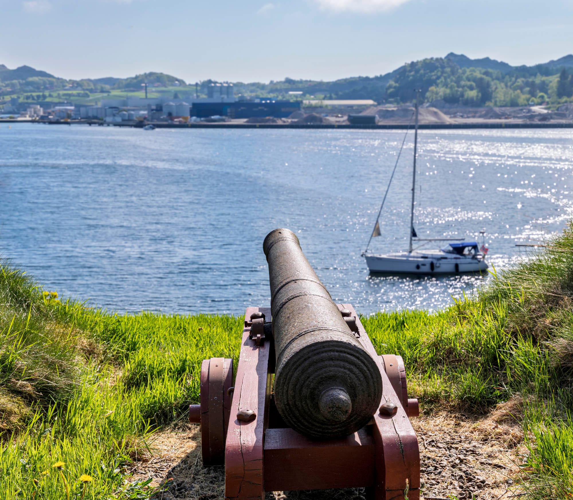
It is an old coastal fortress built in the first part of the 16th century under Christian IV and closed in 1826. The fort is located at the entrance to Egersund harbour with a view of both the southern and northern straits. Gunpowder houses and cannons have been restored at the fort. At the foot of the battery, in the sea, stands the aluminium figure "Linda" by artist Hanny T. Konttinen.
Access: from the city centre towards Eigerøy, turn left before the tunnel, then right and then left into Åsanevegen. Drive through the factory area where there is a car park. Look for the wooden stairs that go up diagonally from the road.
Read more about Lindøy Batteri here
Mysinghålå
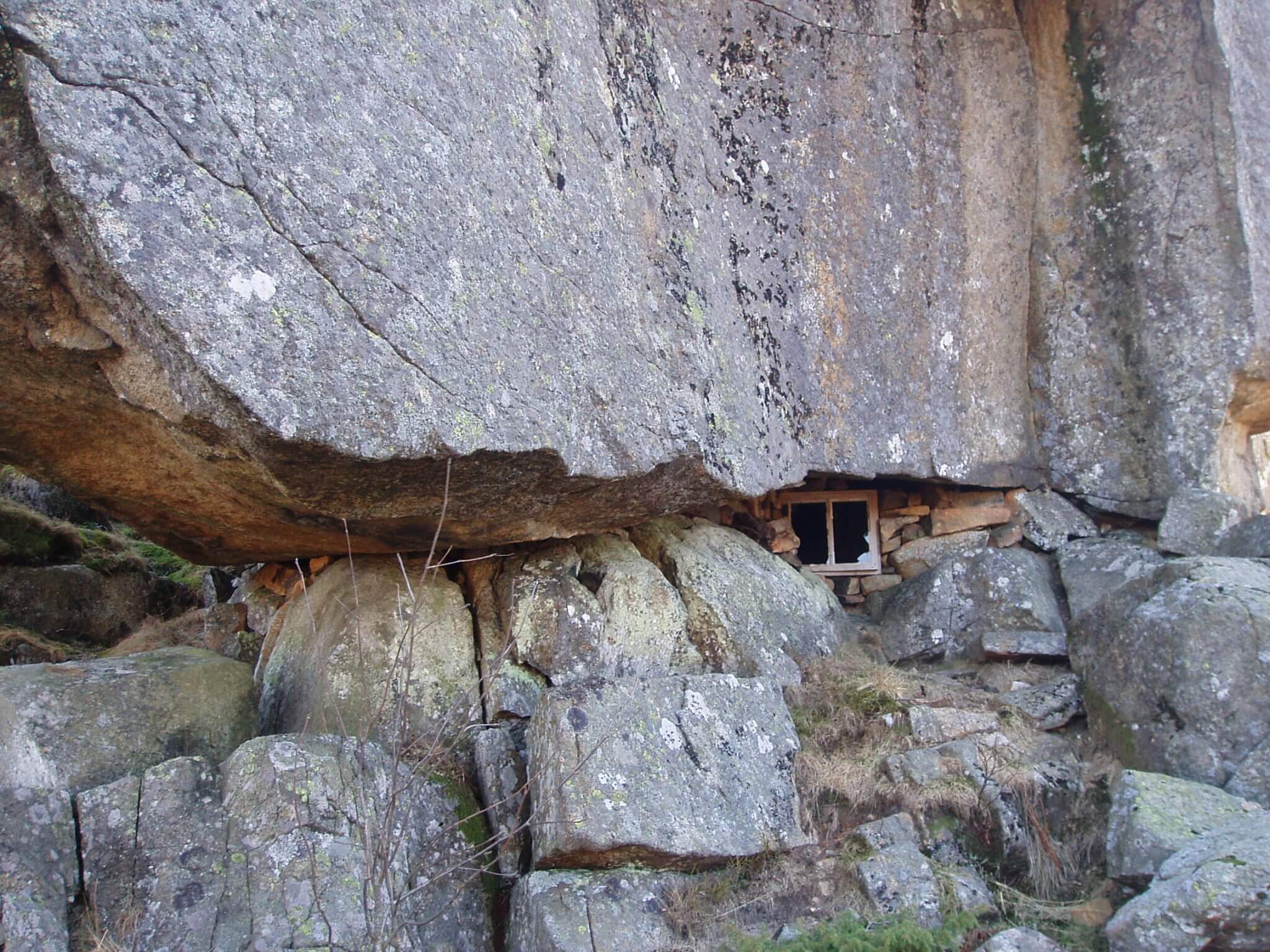
Mysinghålå is located at Mysingheia, Helleland, about 20 km from Egersund town centre. Nice 10 km long marked hiking trail. This is a hiking area with an exciting history. For more than a year, Mysinghålå served as a periodic hiding place for the resistance group Vestige IV from Company Linge ("the Aakre gang"). The cave was furnished with a stove, fireplace, table and window. The hiding place was never found by the Germans. You can also walk 2 kilometres to Hestadfjellet, where you will find the remains of one of the fighter planes that crashed during Operation Freshman (the heavy water operation against Rukan) during the First World War.
Access: from the E39 follow the road towards Mysing and the marked trail from the car park.
Staples
A hiking area with varied experiences in a distinctive rocky coastline with adjacent heather moors and cultivated pastures. Stapnes Fort from World War II is located in the area and consists of bunkers and gun emplacements. Stapnes Fort was one of the first coastal forts built by the Germans in Norway and was one of the few to be actively used in combat against the Allied forces.
For fishing enthusiasts, there are good sea fishing opportunities from land. Restricted all year round. Private area with parking agreement and marked hiking trail. There is a short hiking trail leading to a restored mill house and a small stone vault bridge. The bridge, Litlå klopp, is part of an old road between Egersund and Hauge, and probably dates from the 18th century. This is a picnic area where you can stretch your legs and enjoy a fantastic view of the sea. Toilet, seating areas and cultural monuments.
Access: The exit from fv. 44 to Stapnesveien is not signposted. Stapnes rest area (Kvednavika).
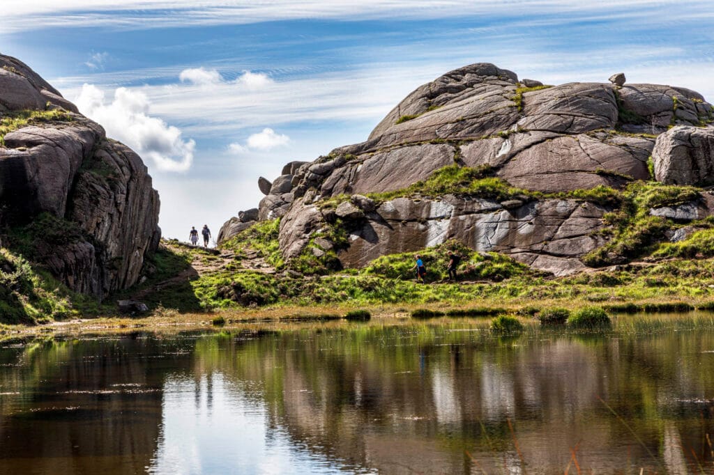
The four city mountains in Egersund
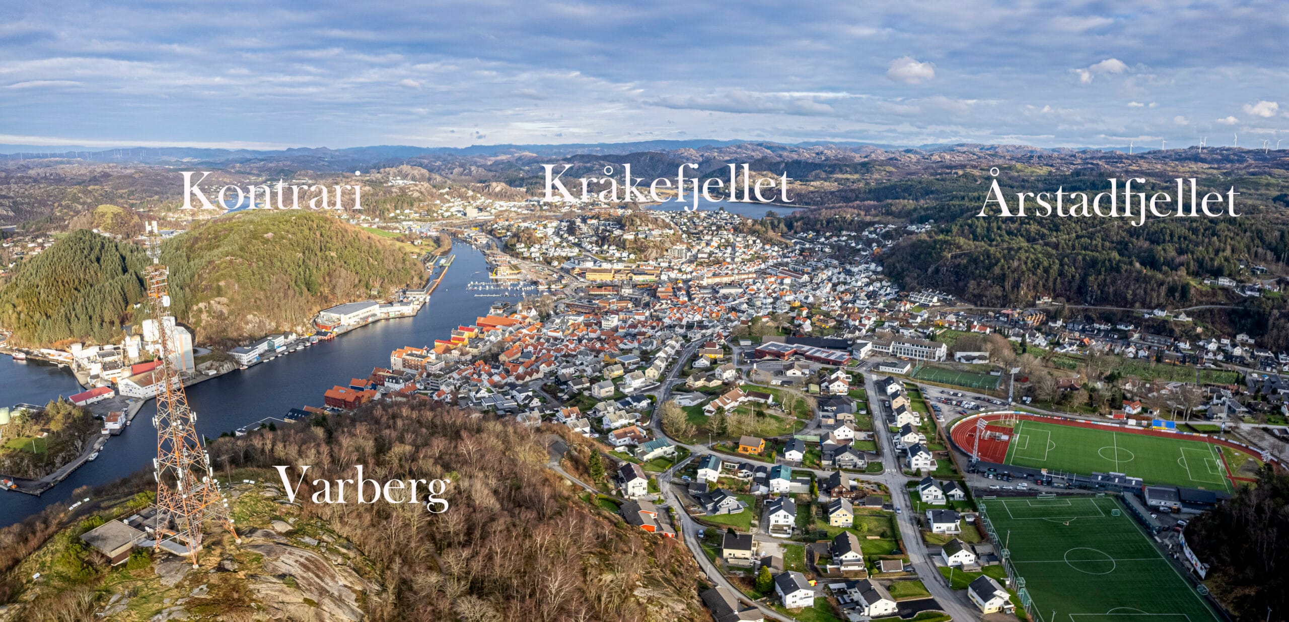
Bergen is known as the city between the seven mountains. Egersund may be smaller in size, but it's richer in proximity: here you'll find four city mountains around the centre – Varberg, Kontrari, Kråkefjellet and Årstadfjellet.
In Rogaland, not all towns have their own mountains close to the city centre. In Egersund, they are so closely linked to everyday life that they are almost taken for granted - until you move away and miss them.
The city mountains are orientation points, hiking destinations, childhood memories and vantage points. They tell the story of the city, from Bronze Age ship carvings to cairns, wind vanes and modern hiking trails.
What could be better than a historical hike to all four peaks?
Read more about the mountains here