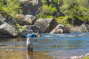
Salmon fishing in Bjerkreimselva
In the Bjerkreim do you have opportunities to land storlaksen, for Bjerkreimselva...

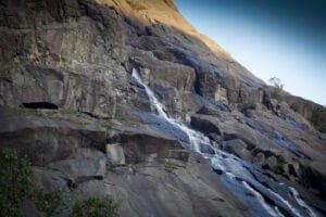
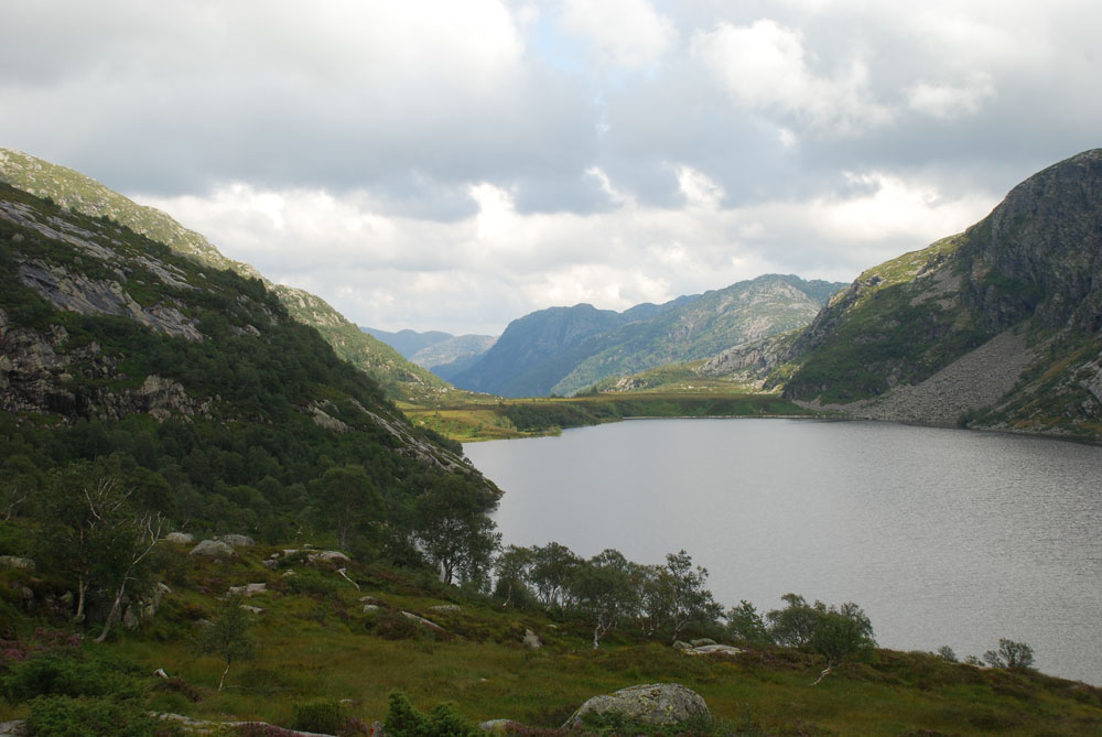
Beautiful Austdalen runs parallel to Ørsdalen in a landscape dominated by the rock gneiss. Here, the extensive Ra moraine can be experienced together with great cultural monuments.
Austdalen starts just after you come out of Ørsdalen from the tunnel, and stretches towards the north-east. Right after the tunnel, there is a beautiful hiking trail that ends up in Bjordal in the heart of Ørsdalen. It is a great, but quite demanding trip that takes 5-6 hours. It is also possible to start from Bjordal and go the opposite way. At Kvitlen there is a DNT tourist cabin, which is a nice place to stay overnight.
Austdalen is the best place to observe the Ra moraine in Magma Geopark. The Ra moraine can be followed across the whole of southern Norway and Scandinavia, and blocks the eastern part of Laugarvatnet. Here the ice stood still for a long time, and the moraine masses thus piled up. Ra comes from Old Norse and means gravel ridge.
If you have two cars, it is a good tip to put one car in Bjordal. It is a good distance to walk from Bjordal and back to the starting point of the trip.
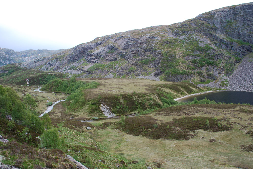
Until 10,000 years ago, most of Norway was covered by ice several kilometers thick. Glaciers in motion act as a conveyor belt. They transport loose masses such as sand, gravel and stone towards the front of the glacier. When the ice recedes, this mass remains and forms end moraines. A lot of loose material is left behind if the ice front remains in one place for a long time, such as in Austdalen.
The best place to observe the Ra moraine in Magma Geopark is in Austdalen. In some places it is admittedly difficult to see, as it is covered with vegetation and in other places eroded away.
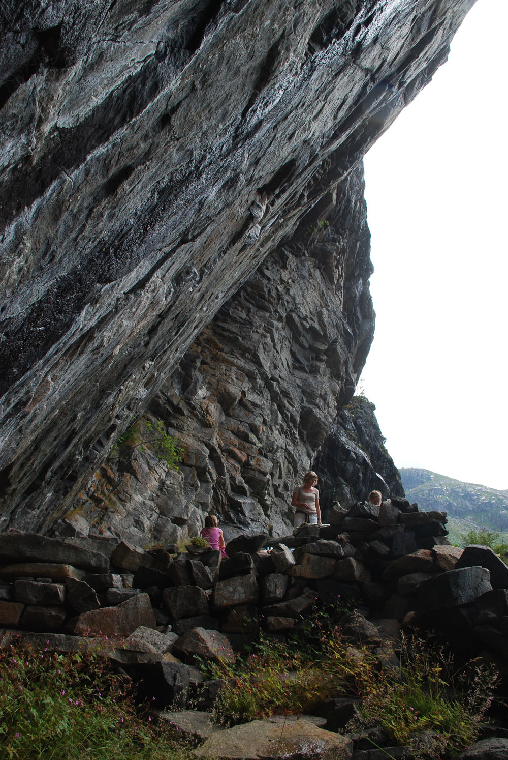
The bedrock in Austdalen and the surrounding area was formed more than a billion years ago and consists of a type of rock called gneiss. When these gneisses were formed, they were part of a mountain range the size of today's Himalayas. These high mountains have long since been eroded away, and the gneisses we see today formed the roots of this mountain range.
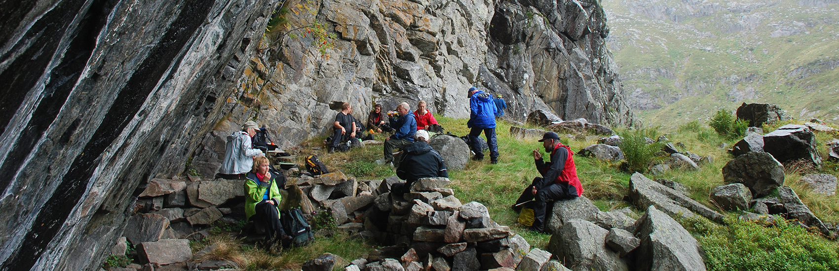
In Austdalen there are stone walls from an old settlement. There is a well-built road and a sætra under the Austdalshedleren. You will also pass the farm Brattebø. At least people have lived on this farm since the end of the 16th century, after the Black Death, and until 1923. It was cumbersome to transport goods from Brattebø, and everything was driven by horse and cart to Laugarvatnet. It was faster to row, so the horse had to walk along the water. On the other side, they met to transport the goods further down to Ørsdalsvatnet.

Category:
Active, Bjerkreim, Geopark, Magma Geopark Sites, Suggestions, Outdoor activities
See more experiences in Magma Geopark